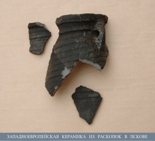
Trade and Communications in the Region of the Pskov-Peipsi Lake

The path down Velikaya River, via the Pskov-Peipsi Lake and through Narova River into the Baltic Sea played a fairly important role among the medieval water routes of the Russian northwest. The broadly branching watershed of the Velikaya enabled navigation to the Pre-Ilmen areas via the rivers Cheryokha and Shelon’, as well as to the mid streams of Lovat’ and Daugava – and further on – to the Volga and Dnieper water arteries. At the same time, the Pskov-Peipsi watershed via the river Narva and the Emajõgi-Pärnu (formerly Embach-Pärnu) system was directly connected to the Baltic Sea.
The choice of waterways and the intensity of their use were greatly determined by the navigating conditions there. In the 19th-century papers there are data on navigation up the Velikaya until Vybuty rapids. A considerable obstacle for vessels was the sandy shoals (bars) in the mouths of the Velikaya and Emajõgi. Navigation across the Pskov-Peipsi Lake – referred to as the Great Lake in the chronicles – due to the frequent winds, open shores, lack of convenient harbors and wind shelters. The biggest complication was the River Narova – both its sources and delta areas had difficult sandy shoals, and in the mid-stream from Lake Verkhovskoye down to the village of Otmut there were the rocky rapids 9.5 km long. The names of shoreline settlements Perevolok and Nemetsky Perevolok (Haul and German Haul) testify vessels used to be hauled by shore here. The waterfall in the mid-stream Narova was totally impassable.
Characteristic of the Pskov-Peipsi Lake Region is the location of settlements at points of convenient mooring and utmost difficult stretches of navigation. Thus, there are concentrations of medieval settlements on the Velikaya and Narova next to the Vybuty and Narva rapids.
It is known that in the second half of the 18th century the transit via the Pskov-Peipsi-Narova waterway was organized as follows: vessels loaded on the Velikaya, Pskov and Peipsi Lakes sailed down to the Narva rapids, and those which passed through into the mouth of the Narova disembarked unto smaller riverine flatboats, which then shipped the cargo to Narva, which served as a transit gateway. These ships navigated to the waterfall, and from there the cargo was transported by land to Narva and further down to the delta in river boats, where the cargo was again reloaded into maritime ships. Haul of boats around the Narva waterfall is mentioned under year 1685, when Gustav Adolf of Sweden “…ordered to bring from Narva by land – to by-pass the said waterfall – various boats that could be used to ship cannonry, ammunition, food supplies and other things to the camp by Pskov”.
An alternative waterway connecting the Pskov-PeipsiLake and the Baltic Sea was the way by the Emajõgi – Lake Võrtsjärv and via a system of rivers and lakes to the River Pärnu and down it towards the Gulf of Finland. The barges are known to have traveled the route to the very port of Pärnu in 18-19th centuries.
The total length of the waterway from Pskov to Narva located 14 km from the Gulf of Finland comprised 220-230 km, i.e. 234-244 km to the mouth of the Narova respectively. In there, 94 km were navigated on rivers – 16 on the Velikaya and 78 on the Narova. When navigating to Reval, another 205 km had to be traveled by the Gulf of Finland. The length of the route from Pskov to Dörpt comprised 147 km, wherein 75 km had to be traveled by the Emajõgi.
Obviously, it would be a mistake to translate the modern navigating conditions to the middle ages, since the hydrographic character of any region changes considerably in the course of time. According to the data from geologists and the underwater archeological research conducted at the site of the Battle on Ice, the configuration of the Pskov-PeipsiLake significantly changed too. Part of the littoral territory in the central section of the TyoployeLake has been flooded. Consequently, in the past this narrow lake rather reminded of a straight, which alleviated the control of navigation there.
Medieval documents contain information allowing to assess the time that was required to travel certain parts of the waterways in question back then. This kind of information is contained in the entry to the Pskov chronicles under year 1473 describing Pskovites traveling to welcome future Russian Tsarina Sophia Palaiologina, who was journeying to Moscow via Reval. The meeting took place at Uzmen’ – modern Mehikoorma – where she arrived apparently by land. The greeters departed from Pskov“on Saturday on the 10th day” and arrived “same week on the 11th day, before dinner, in Uzmen’”. On the way back – with Sophia onboard – the travel naturally took longer, with two overnight camps at Skertovo and Ustye, from 11th to 13th. Thus, a sail trip from Pskov to Uzmen’ – a strait connecting the Pskov and Tyoploye Lakes, 75 km away – took one full day. Such trip was embarked upon in the great nasads, or, according to other sources, in uskuyas provided from each of the six Ends of the city. With these travel speeds, and considering the cross-current on the Emajõgi, it must have taken 3-4 full days to reach Dörpt.